
English| EUR
Suggested for you
More currencies
Choose a language
Portugal's highest point rises straight out of the Atlantic, and the trail up it wastes no distance being gentle. This pico mountain hike difficulty guide breaks down the elevation profile, the graded trail sections between the 45 numbered posts, and the volcanic terrain that governs your footing. Read it before you decide whether the Piquinho cone belongs on your itinerary.
Quick answer
The trail is rated difficult: roughly 1,150 metres of ascent over about 3.5 kilometres, on loose lava rock, with no switchbacks to soften the gradient. Sustained steepness, not technical climbing, is the obstacle. The final Piquinho cone adds a short hands-on scramble. Trailhead access runs 08:00–18:00 daily, and the 08:00–10:00 arrival window exists because the round trip takes 7-9 hours.
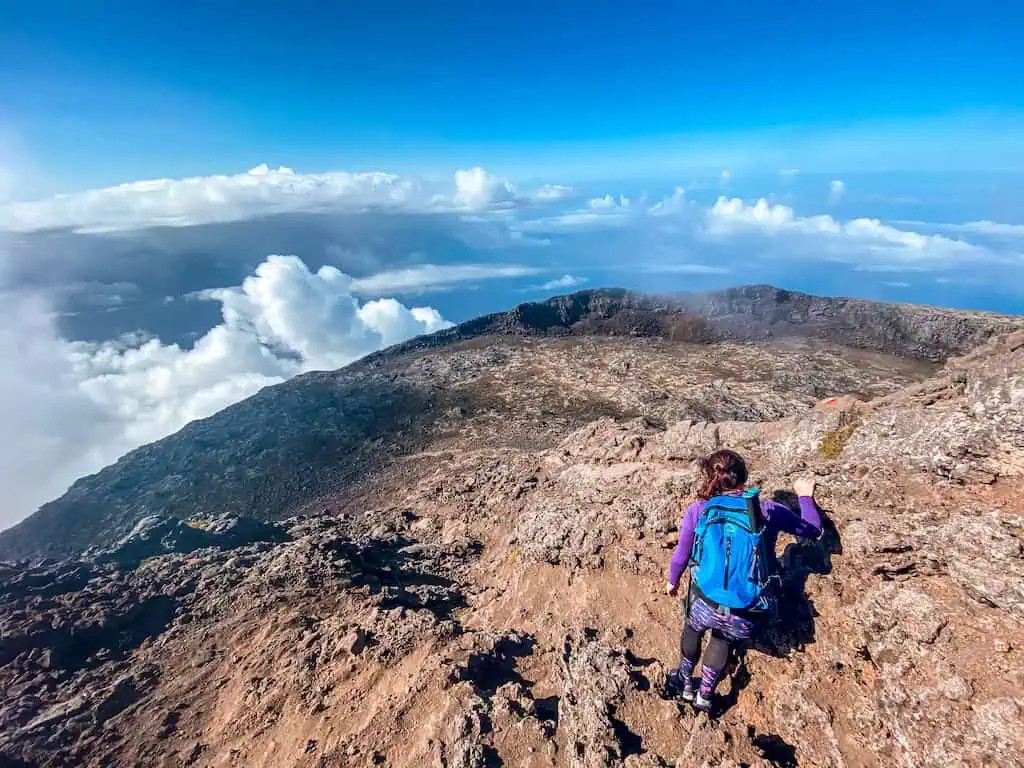
Mount Pico is not a mountain that grew out of a range. It is a stratovolcano standing alone on a small Atlantic island, and its 2,351-metre summit is the highest ground in Portugal — higher than anything on the mainland, reached from a trailhead that sits at roughly 1,200 metres. That geography is the whole story behind pico mountain hike difficulty. There is no approach walk, no valley traverse, no warm-up. From Casa da Montanha, the visitor centre on Caminho Florestal nº 9 in Candelária, the route climbs almost immediately and does not relent until the crater rim. The ascent gains around 1,150 metres across a horizontal distance of only about 3.5 kilometres. Expressed as a gradient, that is punishing; expressed in practice, it means most walkers spend four to five hours climbing without ever finding a flat stretch to recover on. The path is marked by 45 numbered posts, and hikers quickly learn to measure progress in posts rather than kilometres. The surface underfoot is basalt and scoria — sharp, uneven, sometimes loose. Ankles work constantly. Sections between posts 12 and 30 involve stepping up onto rock ledges knee-high or higher, which is closer to climbing a broken staircase than following a path. Nothing is technical in the mountaineering sense, but the cumulative load on quadriceps and knees is what separates the Pico Island volcano trail from an ordinary long walk. The descent is frequently harder than the ascent, because the same ledges must be lowered down on tired legs, and most injuries reported on the mountain happen on the way back. Above post 45 the trail reaches the crater rim at Planalto, a broad saucer of old lava roughly 2,250 metres up. Many hikers stop here, and stopping here is legitimate. The final section — the Piquinho, a secondary cone rising another 70 metres from the crater floor — is a short scramble requiring hands on rock, with exposure that some find uncomfortable. Fumaroles vent warm sulphurous steam near the top, a reminder that the volcano is dormant rather than extinct. Weather compounds everything. Cloud can close over the summit in twenty minutes, visibility drops to a few metres, and the numbered posts become the only navigational reference. Wind on the exposed upper slopes is routinely stronger than forecasts for Madalena suggest. Who manages it? Regular hikers with sound knees and a tolerance for sustained effort generally reach the rim. People who walk occasionally on flat ground usually do not, and turning back is common. The Azores Natural Park regulates access, tracks every party electronically, and enforces the daily 08:00–18:00 window precisely because the pico mountain hike difficulty leaves no margin for a late start. Registration happens in person at Casa da Montanha; the park can be reached on +351 967 303 519, and conditions are published at parquesnaturais.azores.gov.pt. Guides are not mandatory but are widely used, and on a clouded day they earn their fee. Treat the assessment above as the deciding factor, then plan the hours, the packing list and the season around it — each has its own section on this site, and each assumes you have already been honest with yourself about the climb.
“Progress on Pico is measured in numbered posts, not kilometres — and the descent is where tired legs get tested.”
This plan suits reasonably fit hikers attempting the full ascent to Piquinho and back in a single day, with the round trip running 7-9 hours from trailhead to return. Timings assume the recommended 08:00-10:00 arrival window at the Casa da Montanha visitor centre.
Check in at the mountain house at Caminho Florestal nº 9, collect your GPS tracker and confirm your return time. Allow 20-30 minutes here, longer in July and August when small groups queue for registration.
The first third of the Vereda do Pico climbs steadily over loose volcanic scree between the numbered trail posts, gaining roughly 400 metres. Set a slow, sustainable pace now, as the gradient steepens rather than eases.
The middle stretch is the longest and steepest, with hands-on scrambling over lava blocks. Expect 2-3 hours to reach the crater rim, and treat this section as the point where you honestly assess whether to continue.
Crossing the crater floor takes about 20 minutes before the final 70-metre scramble up Piquinho to 2,351 metres. Keep the summit stop to 30 minutes so fatigue does not build in cooling air.
Descending takes 3-4 hours, not the shorter time most hikers expect, because tired legs and loose scree slow every step. Poles and deliberate foot placement matter more now than on the way up.
Sign out and return your tracker before 18:00. Budget the full 9 hours rather than 7, as most hikers finish nearer the upper end of the range.
Gear determines whether Pico's loose volcanic rock and fast-shifting summit weather stay manageable, so assemble these items in the weeks before your climb rather than the night before.
The best arrival window is 08:00–10:00 to ensure sufficient daylight for the hike. Selecting the right season minimizes weather-related difficulty and maximizes trail visibility.
Stable, 15°C to 22°C
Dry trails reduce technical difficulty, though warm temperatures increase physical exertion requirements.
Unpredictable, 10°C to 18°C
Increased chance of rain and wind complicates footing; snow may persist on the summit.
—
Starting early within the 08:00–10:00 arrival window avoids bottlenecks on technical sections and manages core body temperature effectively.
Verdict: The best slot for a balanced experience is a weekday between 08:00–10:00 during the stable weather windows of June or September.
Everything you need to know about pico mountain hike difficulty
The pico mountain hike difficulty is classified as demanding due to the steep, rocky terrain and significant elevation gain. Hikers should be prepared for a strenuous ascent through volcanic soil and loose basalt rocks.
While not strictly requiring technical mountaineering skills, the pico mountain hike difficulty necessitates a high level of physical fitness. Consistent physical activity is recommended to handle the sustained incline and the nature of the terrain.
The total time required is 7-9 hours for the full round-trip hike. Proper pacing is essential to manage the pico mountain hike difficulty and ensure a safe descent before nightfall.
Navigating the rugged, uneven landscape requires good balance and knee stability. The pico mountain hike difficulty is compounded by weather variability, which can change rapidly at higher altitudes.
The trail is generally not recommended for young children due to the high intensity and technical nature of the climb. Guardians should evaluate their child's endurance against the strenuous physical demands of the trail.
The ascent involves a significant gain from the base to the summit, known as Piquinho. This rapid elevation change is the primary factor influencing the pico mountain hike difficulty, requiring climbers to monitor their breathing and exertion levels.